Nature Intelligence for Complex Infrastructure
From linear corridors to catchments, NatureMetrics provides trusted data to support consenting, construction, and long-term compliance.
Over 200 infrastructure projects globally use NatureMetrics
24
months
saved during permitting
70%
reduction in
monitoring costs
$100m’s
in asset value
safeguarding


Nature-related risks are financially
material, but hard to measure
The cost of conventional monitoring, accessibility of sites, and
poor and fragmented data pose barriers to effective nature risk
management. NatureMetrics is changing this.
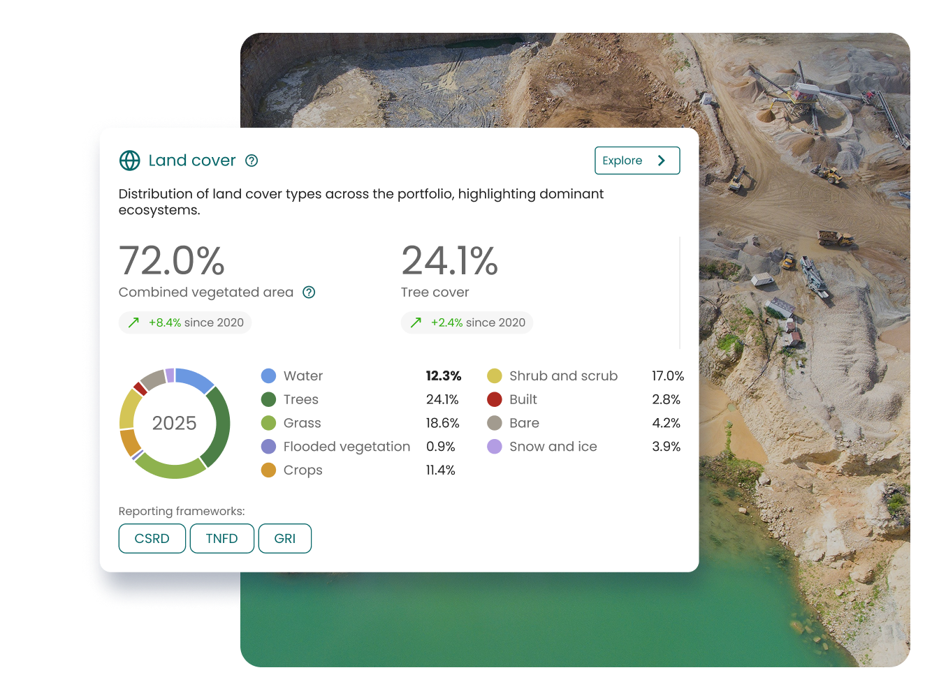
Mission Control for
Nature-related Operations
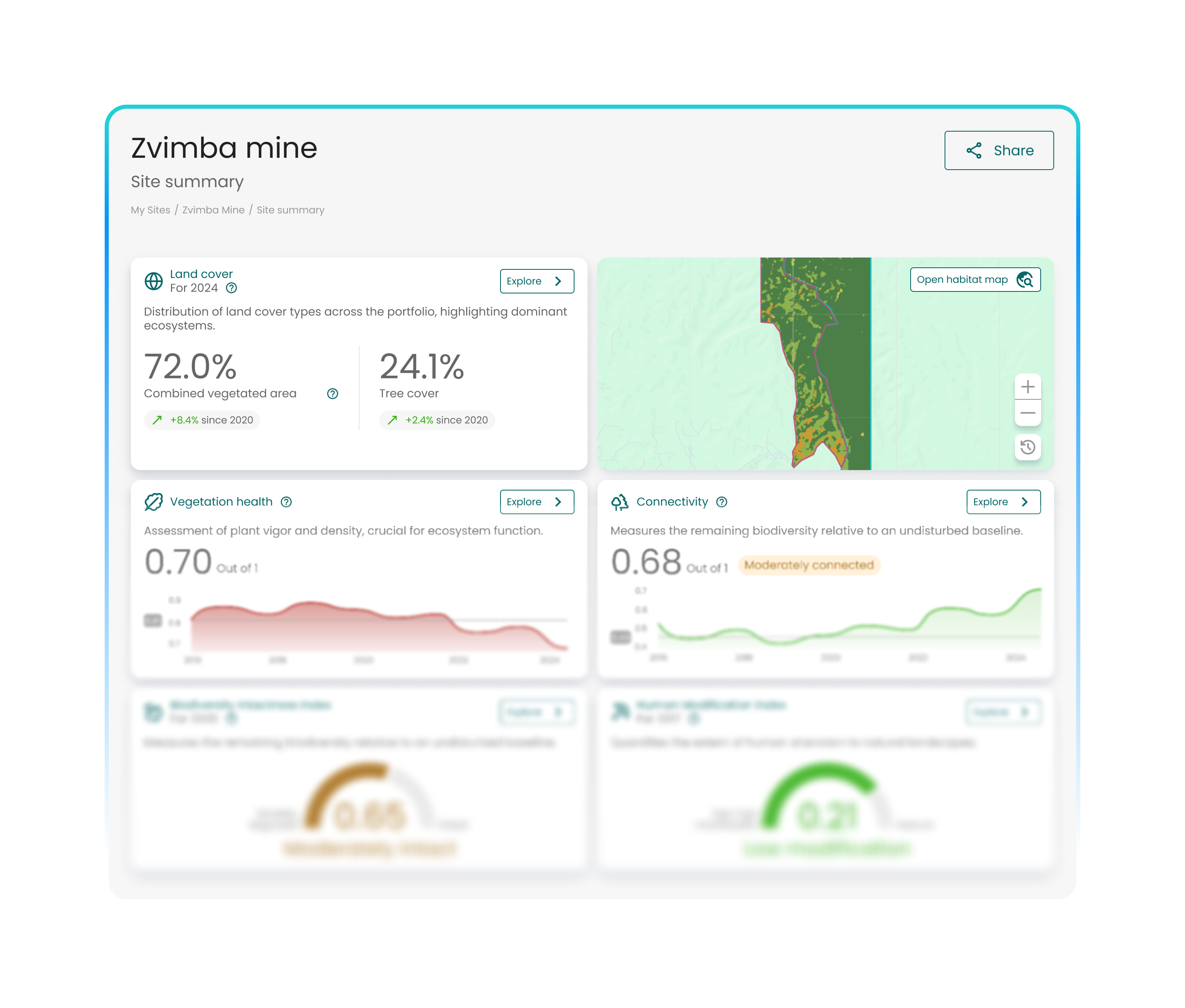
Ongoing insights to inform major infrastructure, from roads & rail to water utilities
- Species-level data from high-integrity eDNA surveys
- Compliance-ready habitat insights from geospatial and modelled data
- Integrate existing biodiversity data, including bioacoustics & visual surveys
- Aggregated portfolio and site-level views
- Consultancy from renowned nature experts
- AI-powered insights and predictive analytics
Keep Projects Moving, Even When Survey Windows Close
- Break Free from Seasonal Constraints. Extend survey capability beyond narrow species windows to avoid 12-month programme delays.
- Accelerate Baselines and Updates. Generate defensible species data in days, not months, to support EIAs, DCOs, and construction-phase changes.
- Reduce Repeat Site Visits. Capture multi-species insight from a single sample, cutting field time across complex programmes.
Reduce Heath & Safety risks
Reduce High-Risk Lone Working
Replace repeated night-time and trackside surveys with simple sampling that removes the majority of hazardous lone working hours.
Protect Safety Metrics and Reputation
Reduce exposure that directly impacts TRIFR, insurance risk, and client confidence on major frameworks.
Enable Safer Scale
Survey more locations without increasing workforce risk, critical for long, linear corridors.
Species Evidence that Holds up to Scrutiny
- Meet Protected Species Requirements. Detect priority, protected, and invasive species using validated, regulator-accepted methodologies.
- Stand Up to Challenge. Use transparent, real-world data, not black-box models, when facing consultation, objection, or legal review.
- Support Confident Consenting. Reduce the risk of stop-work orders or redesign caused by missed ecological constraints.
Turn Complex Ecology into Clear Decisions
- See Biodiversity Along the Corridor. Visualise species presence, hotspots, and connectivity across roads and rail alignments.
- Target Effort Where It Matters. Focus detailed surveys and mitigation where data shows real ecological sensitivity
- Communicate with Confidence. Translate technical findings into clear maps and evidence that clients, regulators, and the public understand.
Solutions for Every Infrastructure Project

Road Infrastructure
Consistent biodiversity insight across long, complex corridors.

Rail Networks
Defensible ecology without extended trackside exposure.
Bridges & Major Structures
Confidence at sensitive crossings and pinch points.

Dams & Reservoirs
Understand upstream and downstream ecological risk.

Water Utilities
A single, trusted view of catchment health.

Tunnels & Subsurface
Evidence where access is limited and scrutiny is high.
Leading infrastructure companies choose NatureMetrics
as their nature intelligence partner

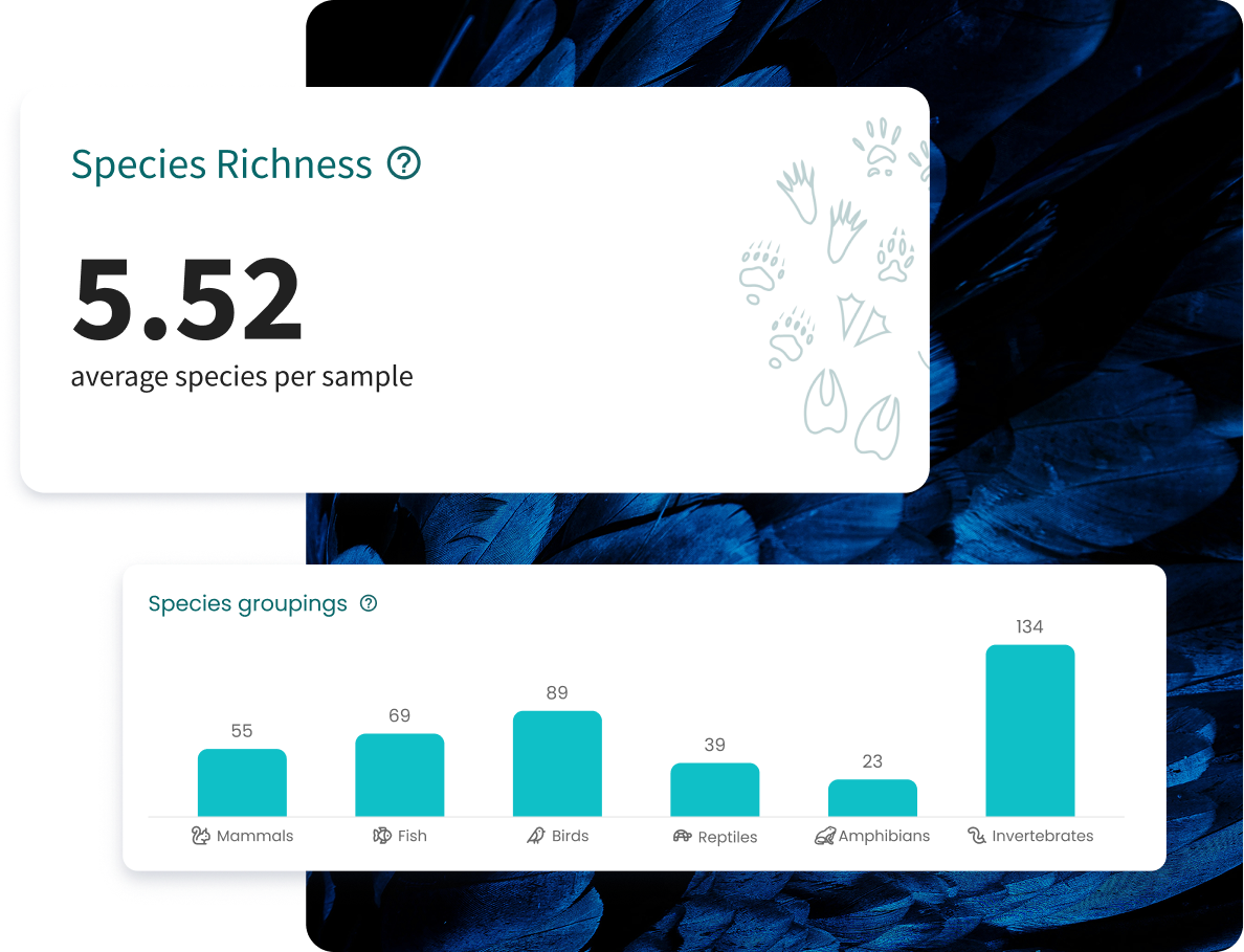
~3,000
Species detected across bacteria, fungi, and soil fauna
10x
More soil fauna identified than traditional survey methods
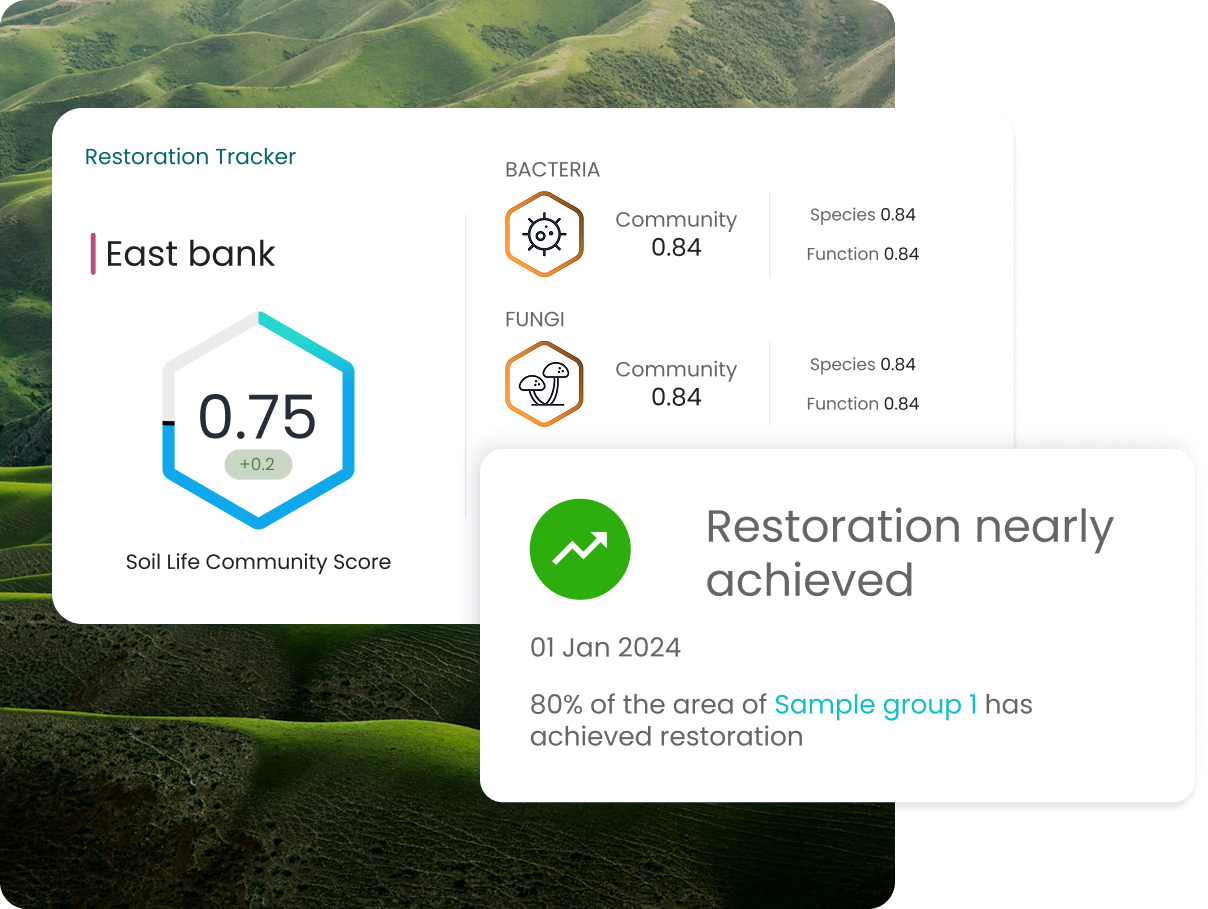
Client Challenge
Jacobs supported Transport Scotland on a major road widening project that required compensatory woodland creation. Traditional soil surveys could not provide the depth or consistency needed to compare habitats or prove long-term restoration success.
Solution
NatureMetrics’ soil eDNA analysis delivered comprehensive biodiversity data across four habitats from a single survey. The approach enabled direct comparison between woodland and grassland soils and informed soil translocation decisions with high confidence.
Results
Distinct soil communities were identified between habitats, defining the ecological gap mitigation must address. The dataset now provides a robust baseline to monitor woodland creation over time and demonstrate ecological equivalence.
Resources
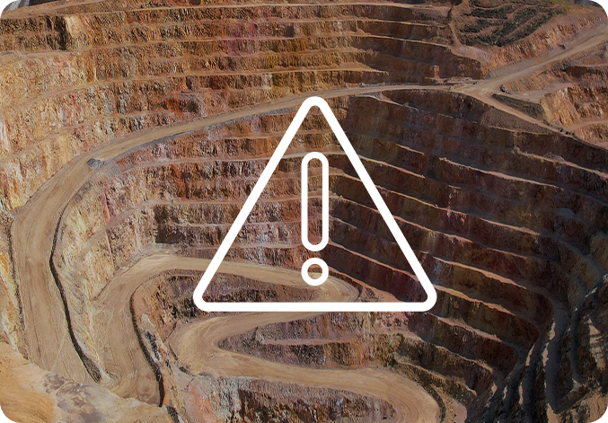
Nature Intelligence for Extractives
Read more >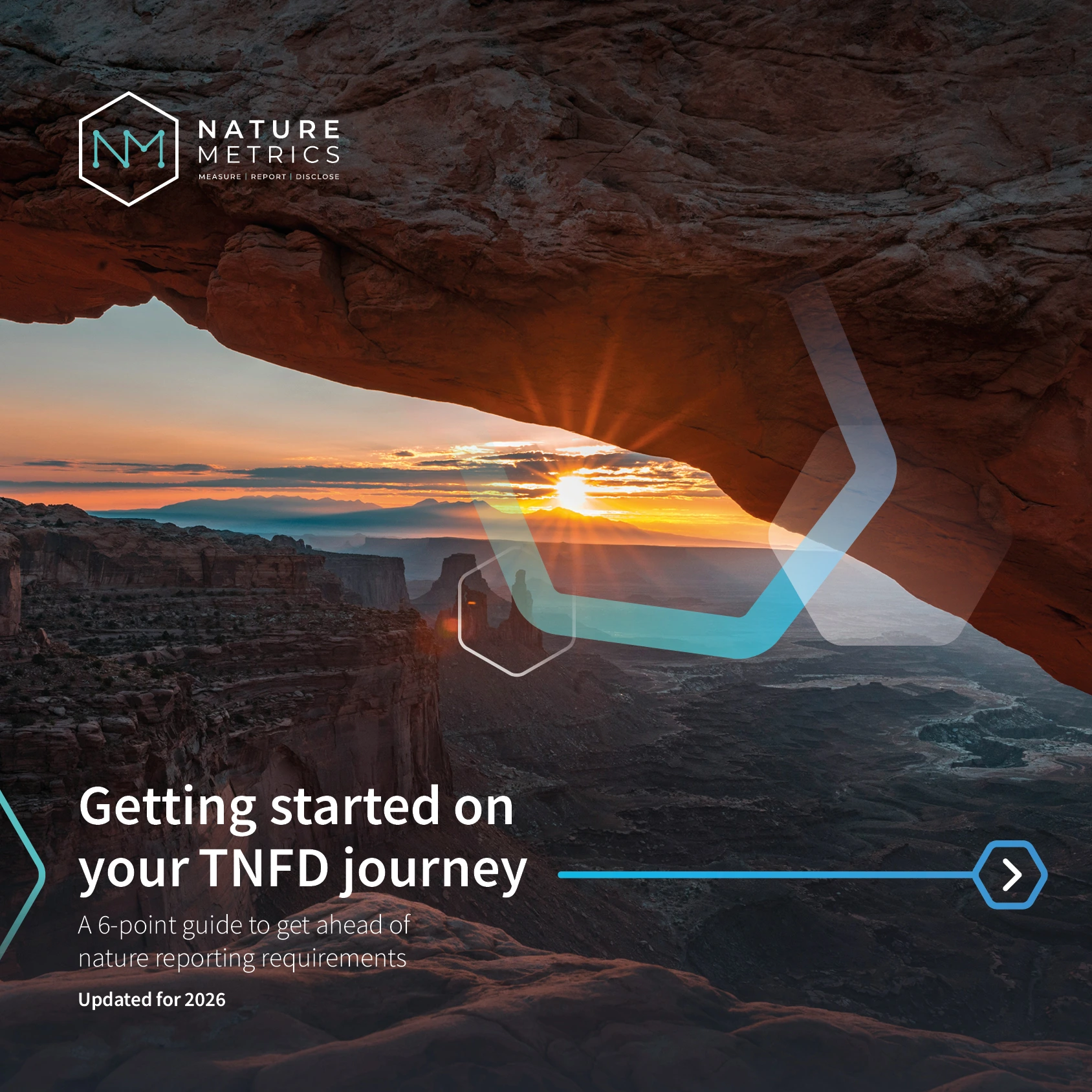
Download our 6-step guide to TNFD
Read more >
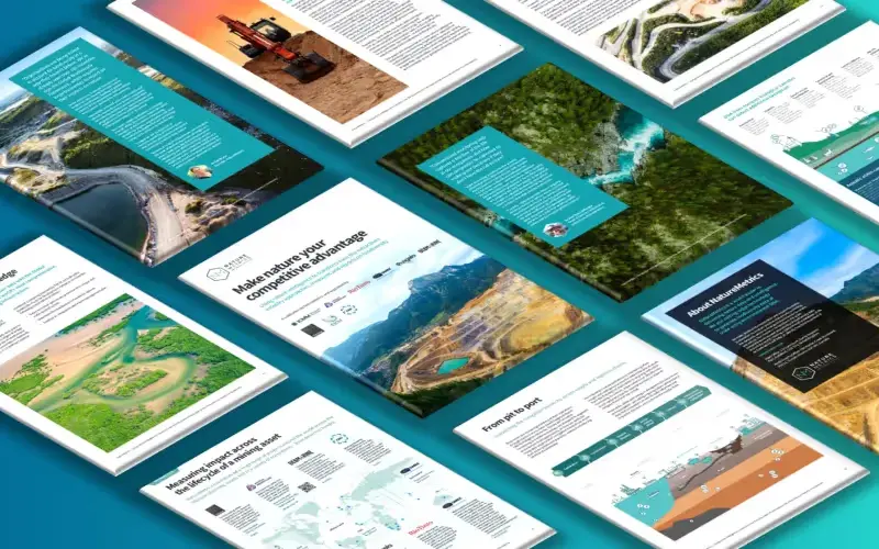
The future of Nature-based Solutions with eDNA
Read more >Book a Demo